Key Takeaways:
- Valles Marineris: Mars’ Valles Marineris, a colossal canyon system, dwarfs Earth’s Grand Canyon and spans 2,500 miles with depths of up to 6 miles.
- Formation Theories: Most scientists propose that the Tharsis volcanic region’s uplift and cracking of the Martian crust gave birth to Valles Marineris.
- Canyon Features: Collapse pits, floods, and landslides hint at past water presence, while chasmata dominate the canyon’s landscape.
- Volcanic Cones: The canyon contains young, small volcanic cones that point to recent magmatic rock volcanism, distinct from liquid mud.
- Ancient Water: The system likely drained into the Chryse region, possibly connecting to an ancient Martian lake or ocean.
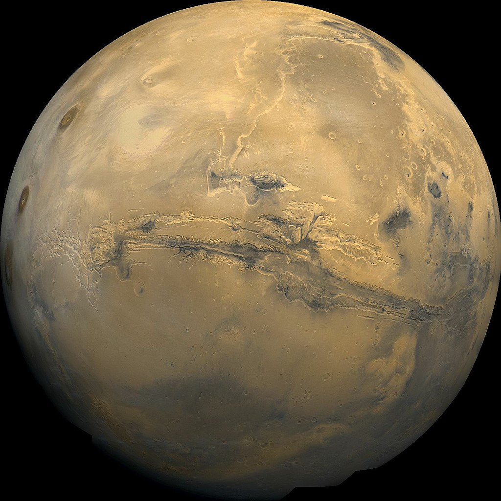
The Red Planet’s Valles Marineris, aptly titled the “Grand Canyon of Mars,” captivates with its awe-inspiring dimensions and enigmatic origin. Extending nearly a fifth of Mars’ circumference, this colossal canyon system dwarfs Earth’s renowned Grand Canyon, showcasing its expanse across approximately 2,500 miles. Impressively, at certain points, the canyon widens to a staggering 125 miles, while plunging depths of up to 6 miles add to its mystique. In comparison, Earth’s Grand Canyon is dwarfed at 227 miles in length and 1 mile deep. This Martian marvel, stretching from Noctis Labyrinthus to the Chryse Planitia basin, offers tantalizing insights into the planet’s geologic past.
Theories surrounding Valles Marineris’ formation are as intriguing as its dimensions. While early hypotheses included erosion during a water-rich era and subsurface magma withdrawal, current consensus leans toward the Tharsis region’s role. This volcanic hotspot harbors immense volcanoes like Olympus Mons, contributing to the planet’s distinct features. The process involved the uprising of molten rock, fracturing the Martian crust, and eventually paving the way for the colossal canyon’s birth. The fracture’s growth over time, along with the seeping of groundwater, shaped the canyon’s intricate network, while signs of acid-rock interactions suggest glaciers might have played a role.
The canyon’s diverse features hold clues to Mars’ watery past. Collapse pits, evidence of floods, and signs of past seeping water indicate the presence of liquid on the planet’s surface. Notably, chasmata, akin to Earth’s canyons, dominate the landscape, leaving astronomers and planetary scientists in awe. The canyon’s allure also lies in its unexpected volcanic cones, testaments to recent magmatic rock volcanism, suggesting a dynamic geologic history. Moreover, the canyon’s potential connection to an ancient Martian lake or ocean, possibly found in the Chryse region, deepens the intrigue surrounding this enigmatic planetary feature.
Unveiled by NASA’s Mariner 9 spacecraft in 1972, Valles Marineris continues to captivate our imagination and expand our understanding of Mars’ geological evolution. As research advances, the secrets of this Martian marvel promise to reveal further insights into the Red Planet’s rich history and its potential to have hosted ancient water bodies.
Read full article on Space.com
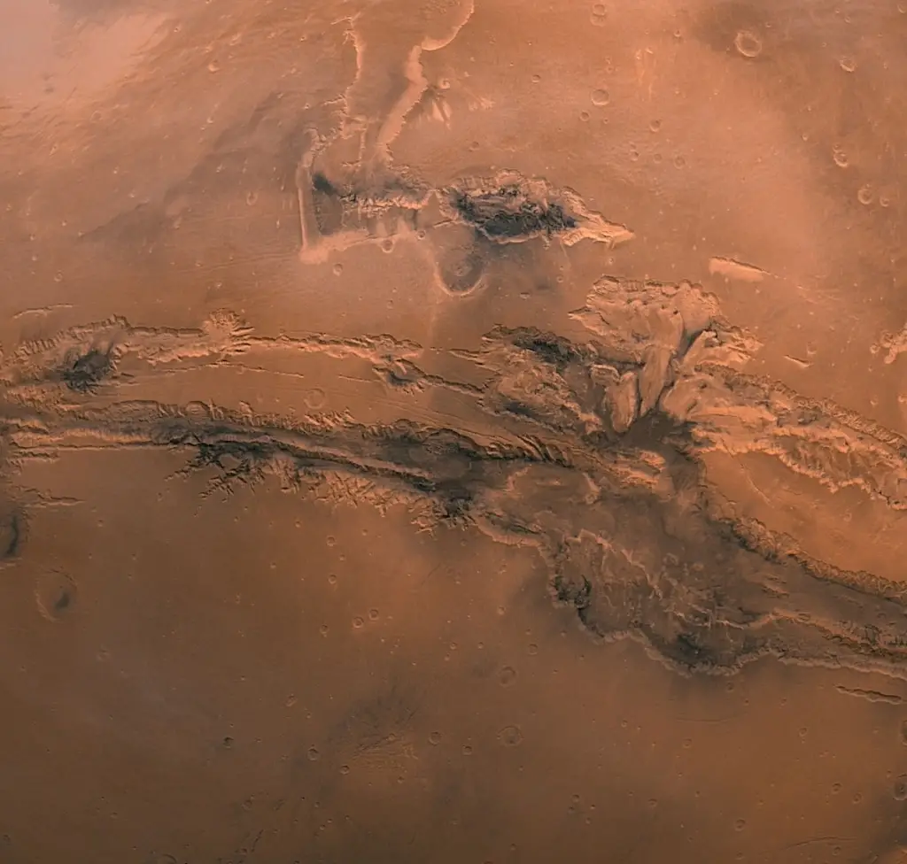
#1
Global mosaic of 102 Viking 1 Orbiter images of Mars taken on orbit 1,334, 22 February 1980. The images are projected into point perspective, representing what a viewer would see from a spacecraft at an altitude of 2,500 km. At center is Valles Marineris, over 3000 km long and up to 8 km deep. Author: NASA / USGS
#2
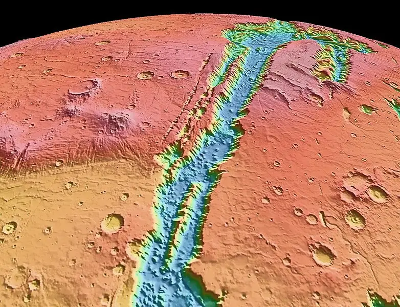
#3
Author: NASA / JPL-Caltech / USGS
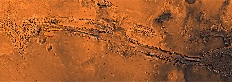
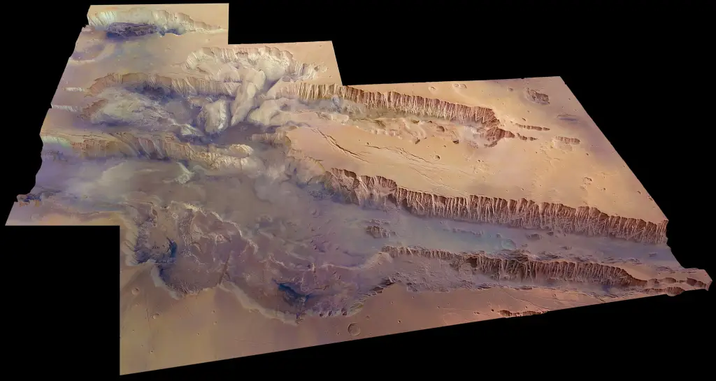
#4

This mosaic image of Valles Marineris – colored to resemble the martian surface – comes from the Thermal Emission Imaging System (THEMIS), a visible-light and infrared-sensing camera on NASA’s Mars Odyssey orbiter. Mars Odyssey was built by Lockheed Martin and the mission is operated by the Jet Propulsion Laboratory. NASA / JPL-Caltech / Arizona State University
#5
The image was first published in 2009 in the ESA science monograph Mars Express: The Scientific Investigations
#6

#7