Key Takeaways
- Arcus clouds are low, horizontal cloud formations often seen alongside cumulonimbus clouds. The two primary types are roll clouds and shelf clouds.
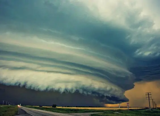
- Shelf clouds are wedge-shaped arcus clouds attached to the base of thunderstorm cumulonimbus clouds. They indicate rising air motion and often look turbulent underneath.
- Shelf clouds form on the leading edge of a storm, while wall clouds are typically at the rear. A sharp gust front can make the leading edge of a shelf cloud appear ragged.
- Roll clouds are rare, tube-shaped, and detached from other clouds. They appear to roll horizontally due to varying winds at different altitudes.
- The Morning Glory cloud in Queensland, Australia, is a famous example of a roll cloud. It’s caused by mesoscale circulation associated with sea breezes.
Arcus clouds, a captivating meteorological phenomenon, have captured the imagination of weather enthusiasts and casual observers alike. These low, horizontal cloud formations often make appearances alongside cumulonimbus clouds, adding drama to the skies. The two primary subtypes of arcus clouds are roll clouds and shelf clouds, each with its unique characteristics and formation patterns.
Shelf clouds, resembling a low, wedge-shaped arch, are typically attached to the base of thunderstorm cumulonimbus clouds. These clouds are not exclusive to thunderstorms, though; they can form with various convective clouds. What makes shelf clouds fascinating is their ability to reveal the dynamics of the storm. Rising air motion can often be observed in the leading part of the shelf cloud, while the underside appears turbulent and wind-torn.
As a storm cloud’s downdraft releases cool, sinking air, it spreads outward as a gust front, undercutting the warm air drawn into the storm’s updraft. This collision of air masses results in water condensation, creating a cloud that often appears to roll with the varying winds above and below—a phenomenon known as wind shear. Sometimes, people mistake shelf clouds for wall clouds, but the key distinction lies in their positioning. Shelf clouds are usually at the storm’s leading edge, while wall clouds linger towards the rear.
A particularly strong gust front can cause the lowest part of a shelf cloud to become ragged, often accompanied by rising fractus clouds and even vortices that resemble tornadoes, known as gustnadoes. This combination serves as a clear indicator of an approaching violent wind squall.
Roll clouds, also known as volutus in Cloud Atlas terminology, are a rarer and more distinct type of arcus cloud. What sets them apart is their complete detachment from other cloud features. These tube-shaped clouds appear to roll horizontally, giving them their name.
Roll clouds are essentially solitary waves, specifically a type called a soliton. Solitons have a single crest and move without altering their speed or shape. The rolling motion of roll clouds is a result of the wind’s varying speed and direction at different altitudes, a phenomenon known as wind shear.
One of the most famous occurrences of roll clouds is the Morning Glory cloud in Queensland, Australia, which graces the skies up to four out of ten days in October. These coastal roll clouds are associated with mesoscale circulation driven by sea breezes. While coastal regions are common places to spot roll clouds, they have also been reported inland, dispelling the notion that they are exclusive to the coast.
Notably, roll clouds are distinct from funnel clouds or tornadoes, as they are horizontal vortexes rather than vertical ones. Their unique appearance and rarity make them a captivating sight for meteorological enthusiasts and nature lovers alike.
#1 Shelf cloud in Charlton, MA, USA
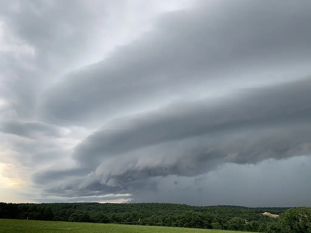
Author: Will y theweatherguy473737
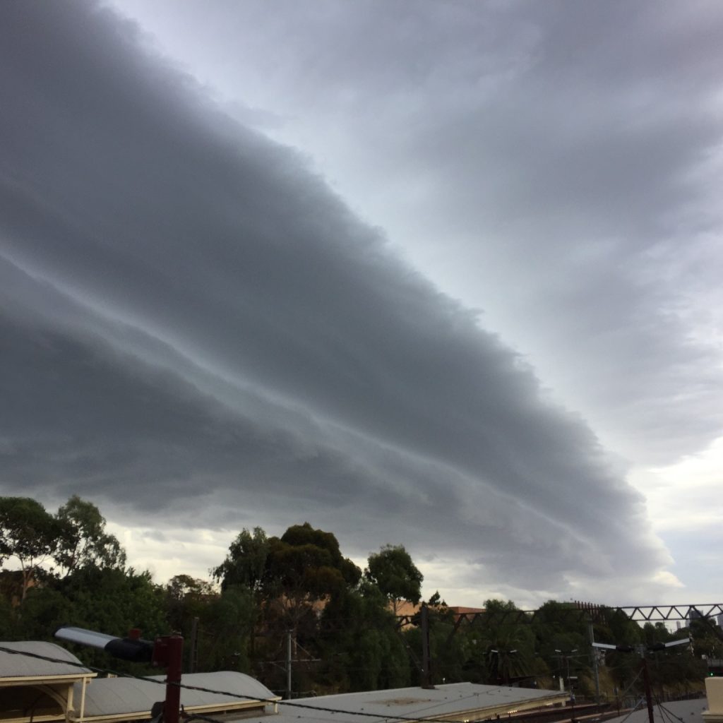
#2 Shelf cloud seen over Swifts Creek, Victoria
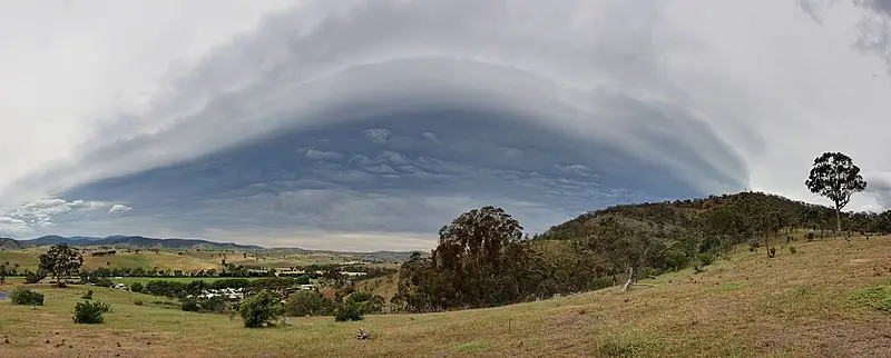
Author: User:Fir0002
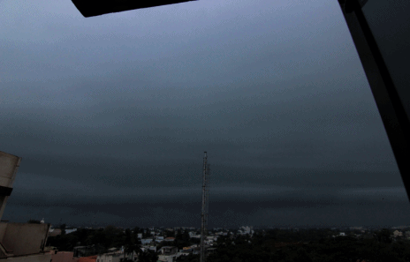
#3 A time-lapse photography of shelf cloud just before a thunderstorm in Pondicherry, India.
#4 A shelf cloud over Enschede, Netherlands
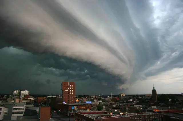
Photo by John Kerstholt
#5 A shelf cloud in Durango, Mexico
Author: Rollcloud
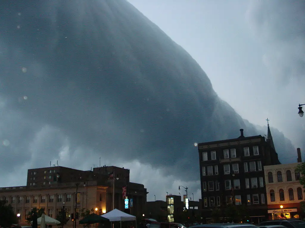
#6 A roll cloud associated with a severe thunderstorm over Racine, Wisconsin, United States
Via Eazydp
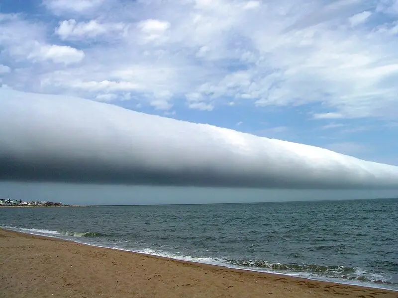
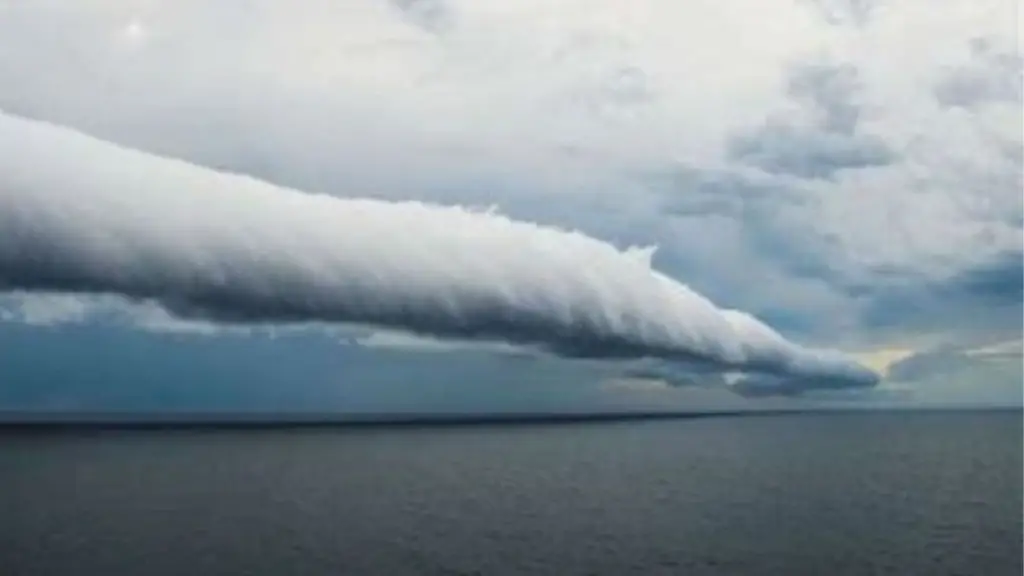
#7 Roll Cloud seen on January 25th 2009, in “Las Olas Beach” located in “Punta del Este” (Country: Uruguay, State: Maldonado)
Via Daniela Mirner Eberl
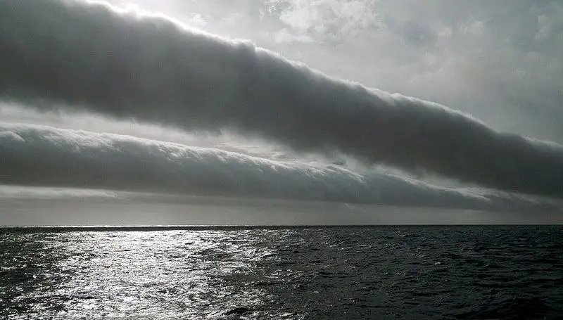
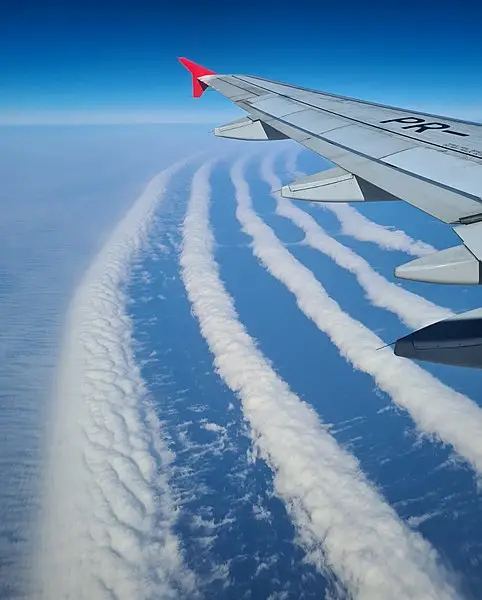
#8 A sequence of volutus clouds at sea in the Southern Ocean.
Via Joshua Stone
#9 Roll clouds over the south of Brazil
Via Gabrielgnunes
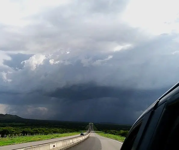
#10 Impressive shelf cloud on the leading edge of a HP Supercell near Bundaberg, November 2017

Via Dee Lange
#11 Roll Cloud captured over Alberta Canada during a cool change

#12
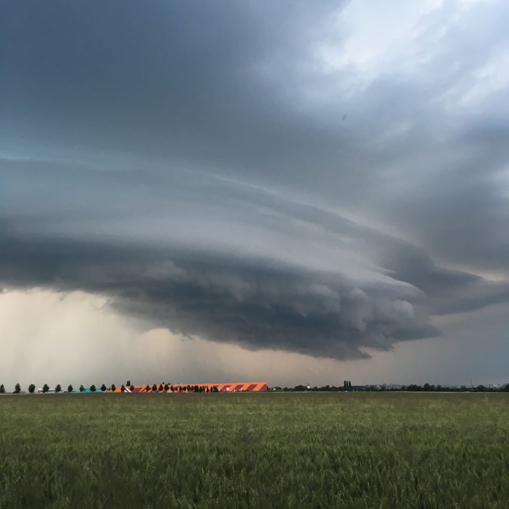
#13 Nupaky, Central Bohemia, Central Bohemia, Czech Republic
#14 Armadale, Stonnington, Victoria, Australia © markjroberts
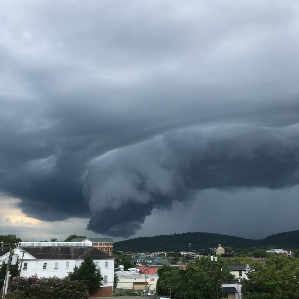
#15 Charlottesville, Virginia, US © hrhartke
#16
#17